Frankfurt train map
You can find on this page the Frankfurt trains map to print and to download in PDF. The Frankfurt trains map presents the rail network and railway stations of the trains of Frankfurt in Germany.
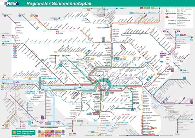
Frankfurt rail map
The Frankfurt rails map shows all the railway stations and lines of Frankfurt trains. This railway map of Frankfurt will allow you to easily plan your route with the trains of Frankfurt in Germany. The Frankfurt rails map is downloadable in PDF, printable and free.
Frankfurt transport system includes a suburban rail system (S-Bahn) capable of reaching outlying communities as well as the city centre as you can see in Frankfurt rail map, and a deep underground light rail system with smaller coaches (U-Bahn) also capable of travelling above ground on street rails.