Frankfurt postcodes map
You can find on this page the Frankfurt zipcodes map to print and to download in PDF. The Frankfurt zip code map presents postal codes, address lookup and code list of Frankfurt in Germany.
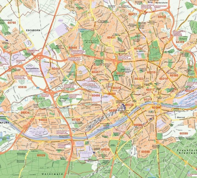
Frankfurt postcodes map
The Frankfurt postcodes map shows all the zip codes of Frankfurt. This zip code map of Frankfurt will allow you to easily find postal codes and address lookup of Frankfurt in Germany. The Frankfurt postcode map is downloadable in PDF, printable and free.
Frankfurt am Main Post Office postcode is 60487. Frankfurt am Main is located in Hessen, Reg.-Bez. Darmstadt, Frankfurt am Main, Stadt Germany as its shown in the map. The map coordinates of latitude and longitude for Frankfurt am Main 60487 are 50.1292, 8.6249 as shown in the map of Frankfurt postcodes.